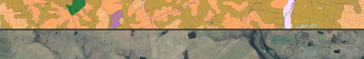
additional maps of Uruguay, soil, fertility, productivity related
 .
.
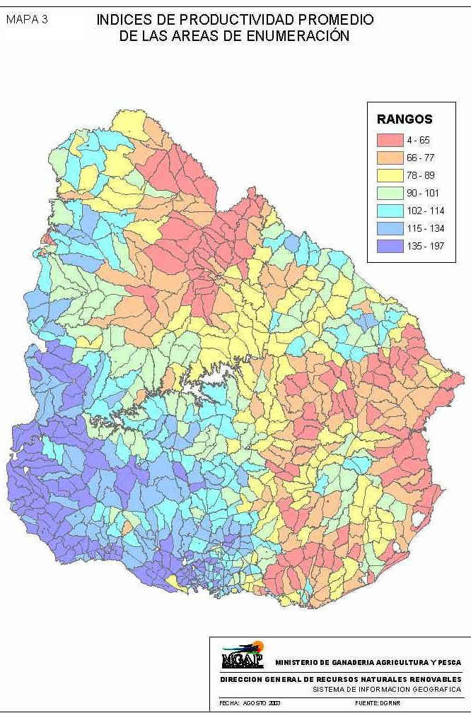
left : soil productivity map as in the CONEAT classification system, increasing from red (low) to dark purple (high)
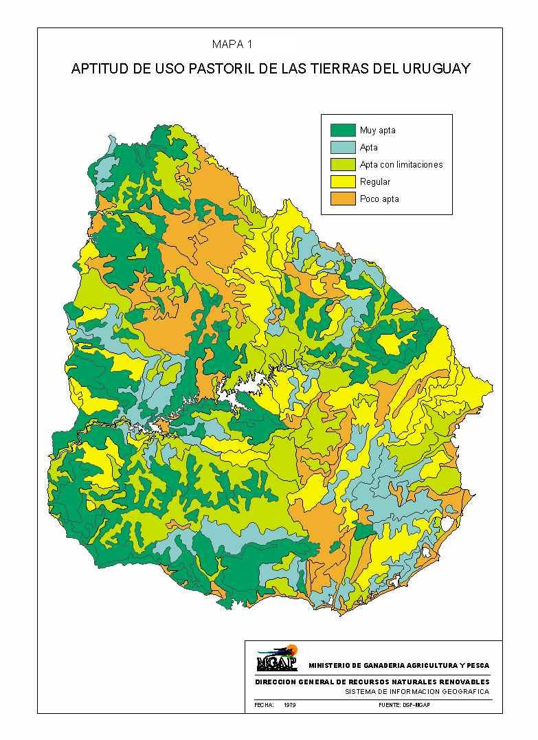
right : soil productivity map based on the same data indicating potential of cattle natural pasture fattening, increasing from brown (low) to dark green (high), a concept today rather replaced by grain farming
for detailed scientific description of each soil type follow links below :

Uruguay soils as classified according to the US system
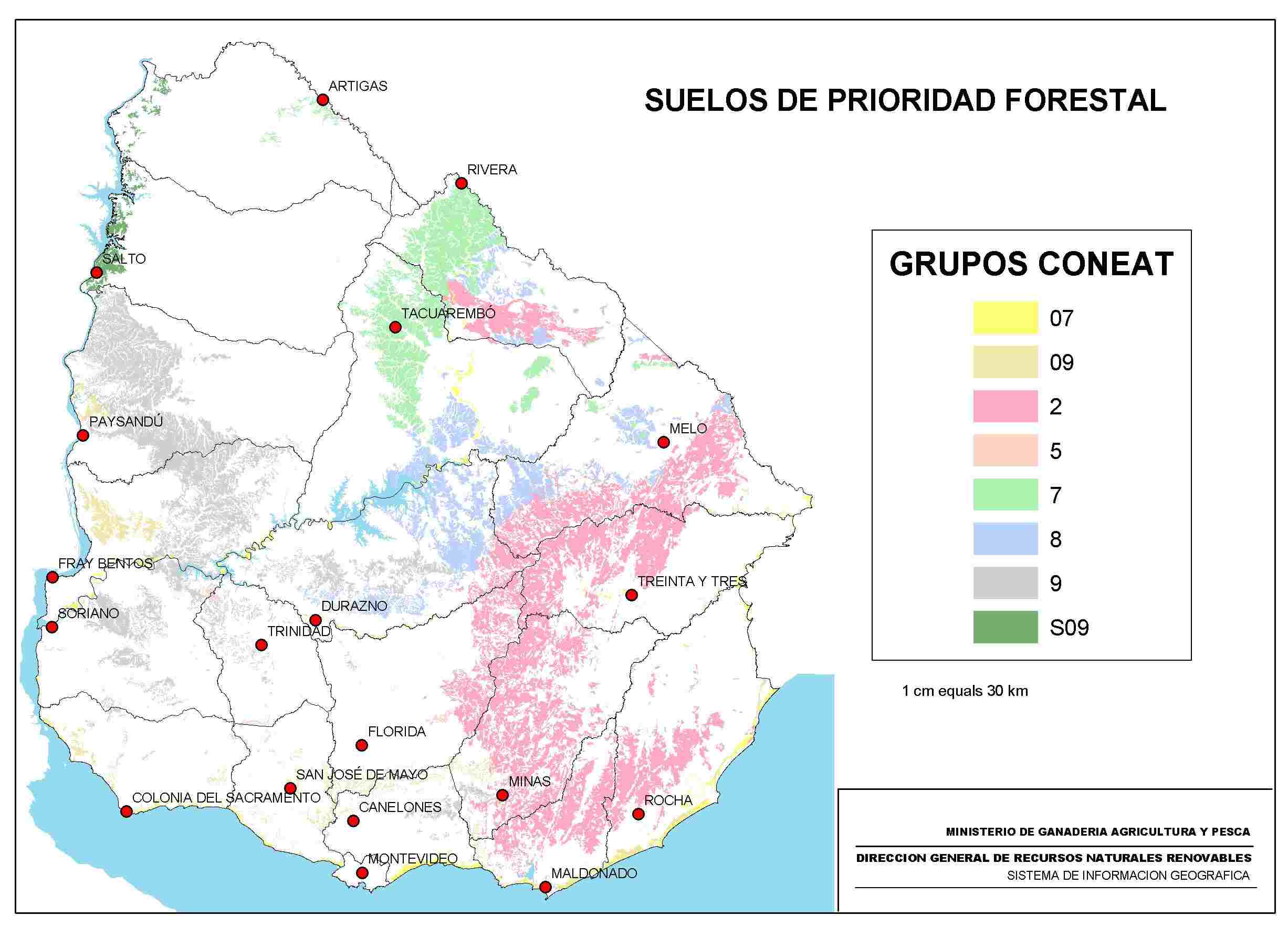
distribution of soils, suitable for forestation and entitled to tax related incentives to plant forests (prioridad forestal)
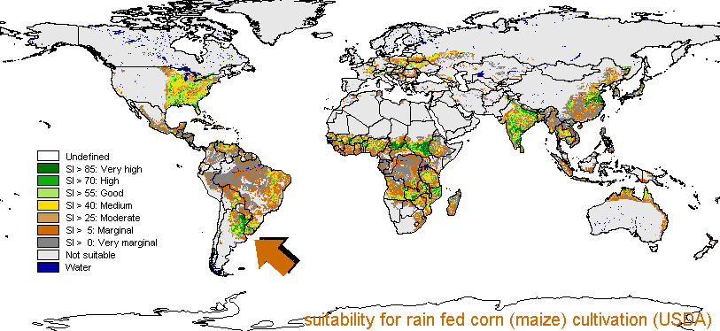
USDA map indicating on a global scale suitability for corn (maize) growing, rainfed (without irrigation)
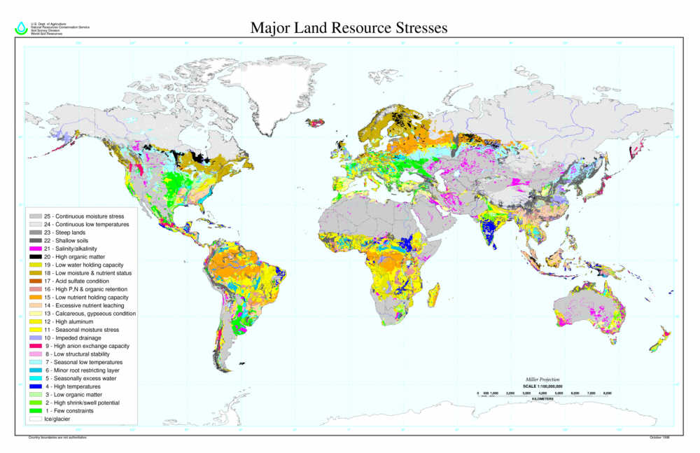
a USDA map of constraints to global agricultural potential, you obviously value most to have few constrains, areas marked bright green on the map